
One of the hikes that Ashley and I had the opportunity to do during a family trip to North Carolina was the Buckquarter Creek & Holden Mill Trail Loop in the Eno River State Park. The Eno River State Park is well maintained and is a great place to go hiking. The Buckquarter Creek & Holden Mill Trail Loop closely follows the Eno River and gives you a great chance at seeing local wildlife. For more pictures make sure to check out our Facebook Page.

Directions to Trailhead: The Eno River State Park is located in Durham and Orange counties, northwest of the city of Durham. There are two options to get to the trailhead for the Buckquarter Creek & Holden Mill Trail Loop, which is located in the Fews Ford Access of the Eno River State Park. The first option is if you are driving from Interstate 85 exit 173, take Cole Mill Road northwest away from Durham. After five miles, Cole Mill Road will end at the park's Fews Ford Access and there are signs directing you toward this trail. The second option is if you are driving from Interstate 85 exit 170, take Hwy. 70 west to Pleasant Green Road. Turn right and follow Pleasant Green 2.2 miles, then turn left on Cole Mill Road. After one mile, Cole Mill Road will enter the park's Fews Ford Access and there are signs directing you toward this trail. For a map click Here, or look at the Google Map below.

Description of Hike: The Buckquarter Creek & Holden Mill Trail Loop is a combination of two different trails into a longer hike. The Buckquarter Creek Trail is a 1.5 mile loop that begins at the Piper Cox Museum parking lot and turns upriver at Few's Ford. The Buckquarter Creek Trail is marked with red dots in addition to the brown signs with white letters. There is roughly a 50 foot rise in elevation with this trail. The most spectacular rapids on the Eno River are viewed from a rock outcrop along this trail. A staircase takes hikers over the outcrop. The trail follows the Eno River and then turns upland going over rolling hills. It is at this point that you connect with the Holden Mill Trail.

The Holden Mill Trail is a 2.6 mile loop trail that continues west from the Buckquarter Creek Trail from a bridge that spans the creek. The Holden Mill Trail is marked with yellow dots in addition to the brown signs with white letters. The best option is to head left and continue along the Eno River. A couple of portions of the Holdern Mill Trail were a little overgrown when we did this hike. On the way back from the end of the Holden Mill Loop there is roughly 250 of elevation gain and loss before you get back to the beginning of the loop. The total roundtrip mileage for this hike is 4.1 miles with 300 feet of elevation gain.

There is no cost for parking and hiking at the Eno River State Park, but there are fee's if you camp in the wilderness campgrounds located in the park. Trail maps are provided at the beginning of the trails near the parking lot. The Eno River State Park contains more than 3,900 acres of wilderness. There are a total of five accesses to the Eno River State Park: Cabe Lands, Cole Mill, Few’s Ford, Pleasant Green, and Pump Station. To find out the times at which the different sections of the Eno River State Park are open click Here. As stated above the Buckquarter Creek & Holden Mill Trail Loop is located in the Few's Ford access point.
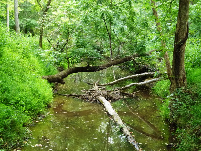
Further Thoughts: Ashley and I really enjoyed our hike on this loop in the Eno River State Park. The majority of the trail was in great shape. A couple of sections on the Holden Mill trail were a little overgrown when we hiked this area. We got a chance to see a lot of wildlife while hiking here at the Eno River State Park. We saw several white tail deer, a number of toads, fish, and a beaver dam. For more information on the ecology of the Eno River click Here.

The Eno River State Park is only minutes from Durham, Hillsborough, and Chapel Hill and it offers secluded wilderness trails with the serenity of a clear river drifting and cascading over a rocky stream bed. The Eno River is a swift, shallow stream flowing from northwest Orange County into Durham County for 33 miles where it joins the Flat River to become the Neuse and flows into Falls Lake. Its waters roll through wilderness, passing historic mill sites, river bluffs covered with flowering shrubs, and fords used by early settlers. Rains can turn the river into a raging torrent, yet it quickly settles into a gentle current. It is a chain of rapids, pools, and riffles meandering through forest on a bed of rock. The valley of the river is narrow and steep walled. The rugged landscape has been carved and sculpted by the swift flowing water.

This loop in particular provides great views of the Eno River. You might even see people fishing in the river when you are on this hike. There is plenty of shade along the entire trail, however there is not as much shade once the trees lose their leaves in the fall. If you are hiking during the warm summer months make sure to bring plenty of water and to use bug spray. The only minor negative about this hike was the high tension power lines that run through a portion of the park. Ashley and I both would recommend a hike in the Eno River State Park the next time you are in North Carolina.
Rating: Elevation Gain: 300 ft. (Easy), Distance: 4.1 Miles Roundtrip (Easy - Moderate).
Time to Complete Hike: 1.5 - 2.5 hours.
Cox Mountain Trail
Buckquarter Creek & Holden Mill Trail Loop (This Post)
Comments
Post a Comment
Ashley and I encourage and welcome our readers to submit comments about their experiences on the trails we have posted on our blog or about their own hiking experiences in general.