Ashley and I attempted to hike to the summit of Mt. San Gorgonio via the South Fork Trail last weekend. Unfortunately, due to summer thunderstorms we were unable to reach the summit of Mt. San Gorgonio and had to turn back for safety reasons several miles from the summit. The hike to the summit of Mt. San Gorgonio is a very strenuous hike, and only those fit enough to hike 23.6 miles roundtrip to the 11,502 foot summit should attempt this hike. Mt. San Gorgonio is the Tallest Mountain in Southern California at 11,502 feet and is a must do for any Southern California hiker. For more pictures of this hike, make sure to check out our
Facebook Page.
Directions to Trailhead: To hike to the top of Mt. San Gorgonio via the South Fork Trailhead, going from Orange County, take the 91 freeway east towards Riverside. Stay on the 91 freeway which eventually becomes the 215 freeway. The 215 freeway eventually intersects with Interstate 10. At the 215 freeway and Interstate 10 interchange, take Interstate 10 going East toward Palm Springs. Exit from Interstate 10 on University which is in the City of Redlands. Make a left and follow University (You will pass through Redlands University) until you meet Highway 38. Take a right on Highway 38, going toward the San Bernardino Mountains. In several miles you will pass the Mill Creek Ranger Station (Where you obtain the additional wilderness permit if you have not gotten it early), continue on up into the
San Bernardino National Forest. Highway 38 will take you to the trailhead. Exit highway 38 onto Jenks Lake Road (This road is located before Barton Flats). Take Jenks lake road a couple of miles and the trailhead is on your left hand side. It is a large parking lot with a big sign indicating the South Fork Trailhead. (A
Forest Adventure Pass is needed as well as a free
Wilderness Permit for the San Gorgonio Wilderness).
Description of Hike: To day hike or overnight backpack in the San Gorgonio Wilderness, you must have an additional wilderness permit (The Permit is Free), in addition to the Forest Adventure Pass. You can
Follow this link for the permit. The link will direct you to the wilderness permit application. You can obtain the additional wilderness permit early from the
Mill Creek Ranger Station which is the easiest way, or you will have to stop at the Mill Creek Ranger Station before you go hiking. Each trail in the San Gorgonio Wilderness has a set quota for the number of hikers allowed on each trail and once the quota is reached the Forest Service doesn't issue more wilderness permits for the trail. That is why I recommend you get your wilderness permit early for your hike to the summit of Mt. San Gorgonio. You can obtain a permit 90 days before your hike.

Mt. San Gorgonio is located in the San Gorgonio Wilderness (approximately 58,969 Acres). The total length of the hike to the summit of Mt. San Gorgonio via the south fork trail is 23.6 miles roundtrip with a 4,601 foot elevation gain. This is a very popular trail to hike to the summit and you will likely see people on the trail as well as in the campsites. The permit quota often fills up for this hike, especially during weekends during peak summer months, so get your free wilderness permits in advance. The trail is well maintained and is usually in good condition. All trails are well marked, except right by Dry Lake. This hike is very strenuous and only fit hikers should hike to the summit. It is a good idea to train on other hikes like
Mt. Baden Powell or
Mt. San Jacinto in preparation for this hike.
For this hike you take the South Fork Trail which passes Horse Meadows and then crosses into the San Gorgonio Wilderness. The South Fork Trail goes to the South Fork Meadow, where you take the trail to Dry Lake. There is camping available at Dry Lake (Water is available at Lodge Pole Springs) as well as further up at Trail Flats (No water available). The trail continues all the way to the summit. There are several other trails that go to the summit of Mt. San Gorgonio (
Vivian Creek and Fish Creek). The South Fork Trail is one of the most popular routes to the summit for hikers to use. In our opinion this is the most scenic rout to the top of Mt. San Gorgonio.
Further Thoughts: Ashley and I really enjoyed this hike in the San Bernardino Mountains. We started our hike to the summit of Mt. San Gorgonio at about 8:15am, that way we would be able to make it back down to the car before it got dark. The weather to start the day was great. There was not a cloud in the sky when we began our hike, however both Ashley and I knew that there was a 40% chance of thunderstorms forecasted for the San Gorgonio Wilderness area. The
San Gorgonio Wilderness Association gives weather forecasts, that are worth checking out before you hike in this area. Also you can view a live webcam of Mt. San Gorgonio by clicking
Here, courtesy of
BigBearWeather.com.

Throughout our hike, after the 10am mark, the clouds kept building. We knew from our history of hiking in this area that it was only a matter of time before it began to thunder and lightning. After continuing on for another mile past Dry Lake, we decided to turn around because we did not want to be above the tree line when it began to thunder and lightning. We had hope that the weather would clear from the mountain, but unfortunately that never happened. Our decision to turn back was correct because on our way back down, shortly after lunch time, it began to rain and thunder and lightning. The storm lasted for a couple of hours and we rode out the storm further down the mountain in the safety of one of the hills. Anytime you are hiking in the mountains and the weather looks bad it is always the smart move to not go up above the tree line. Despite the fact that the thunderstorm prevented us from reaching the summit, we really enjoyed this hike. Bottom-line is during the summer months always be on the watch for thunderstorms when hiking in the San Bernardino Mountains. Ashley and I both recommend that anyone thinking of hiking to the summit of Mt. San Gorgonio do some training hikes because this is a challenging hike with significant altitude changes. Also, on the trail to the summit of Mt. San Gorgonio, there is an airplane wreck from 1953, where a military plane crashed into the side of Mt. San Gorgonio during a snow storm. Most of the wreckage is still there. Sadly everyone on the plane was lost.

Along the South Fork Trail,
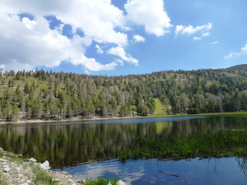
Dry Lake is another notable spot along the hike to Mt. San Gorgonio. It has stellar views of the surrounding San Bernardino Mountains and during most of the year is filled with water. During the summer months and early fall it becomes a meadow until snow returns in the winter. During the winter this area gets a lot of snow. For those that do this hike in the winter always make sure to check the weather conditions and information provided by the San Gorgonio Wilderness Association's Bulletin Board. If you are doing this hike in the winter you will likely need crampons, snow shoes, and good winter gear. Remember, snow can be present for many months of the year on the trail to the summit of Mt. San Gorgonio so make sure to check the conditions if you are doing this hike in late fall, the winter, or the spring. If you do this hike during the cold winter months make sure you are prepared with proper gear as only experienced hikers should do this hike during the winter.
Rating: Elevation Gain: 4,601 ft. (Strenuous), Distance: 23.6 Miles Roundtrip (Strenuous), Note: be on the watch for Altitude sickness since the height of Mt. San Gorgonio is 11,502 ft.
Time to Complete Hike: 9 - 11 hours.
Good Training Hikes:
Mt. Baden-Powell,
Mt. San Jacinto,
Saddleback Mountain,
Cucamonga Peak,
Mt. Baldy.
MORE TRAIL WRITE-UPS ON MT. SAN GORGONIO
Mt. San Gorgonio (Via the South Fork Trail, August 2011)(This Post)


Thank you for the write-up :)
ReplyDelete