Recently Ashley and I had the chance to hike in the San Juan Capistrano Open Space and hike the eagle loop in San Juan Capistrano. The
City of San Juan Capistrano has taken very proactive steps to protect its open space/natural areas for preservation. This hike is a loop that goes through some very scenic wilderness areas, but finishes through a neighborhood. It is a fun hike for those in South Orange County as it offers great views of our local
Santa Ana Mountains and the Pacific Ocean. For more pictures of our hike in San Juan Capistrano make sure to check out our
Facebook Page.
Directions to Trailhead: To get to the trailhead to hike the Eagle Loop in the San Juan Capistrano Open Space, take the 5 freeway heading south towards San Juan Capistrano. You are going to exit the freeway at the exit for Ortega Highway and head toward the Santa Ana Mountains. Make a right onto La Novia. Follow La Novia past San Juan Creek Road and you will eventually make a left turn onto Via Cerro Rebal. Go up the steep hill and the trailhead is on your left at the intersection of Via Cerro Rebal and Via Montoya. There is plenty of street parking at the trailhead and there is no cost for parking at this access to this nature preserve in the City of San Juan Capistrano.
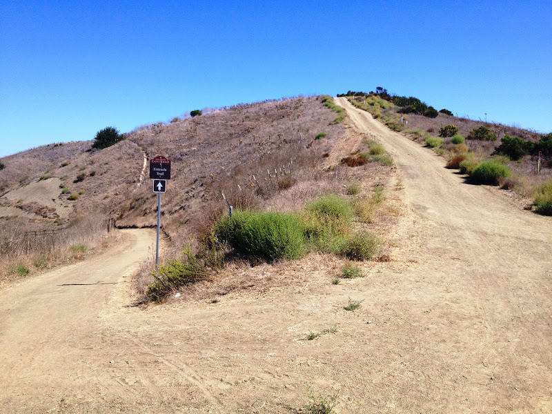
Description of Hike: This hike is a loop through some of San Juan Capistrano's preserved open space. The hike starts on an uneven, but maintained, dirt hiking trail. The hike finishes on a short quarter-mile stretch of the sidewalk. The hiking loop begins on the Cerro Rebal trail, which starts with a strenuous uphill hike. The Cerro Rebal trail levels out when you reach the gated underground reservoir. The Cerro Rebal trail ends in 1.12 miles from the trailhead where you will make a left onto the Prima Deshecha trail which is the "roller coaster" section of the hike with more elevation gain and loss. Make a left onto the Entrada trail. Continue on the Entrada Trail, do not take the first paved trail down into the neighborhood. Once you pass the maintenance shed make a left and follow the paved maintenance road to the street of Via Entrada near the San Juan Hill Golf Course and make a right. Follow along the sidewalk and make a left onto to La Novia. Follow La Novia road and make a left onto Via Cerro Rebal road and hike back up the steep hill to the trailhead. For a map of the hiking trails in San Juan Capistrano's Open Space in Orange County click
Here. The hike has approximately 480 feet of elevation gain to it and is approximately 3.5 miles roundtrip.
Further Thoughts: Ashley and I enjoyed this hike in the San Juan Capsitrano Open space and we enjoyed the Eagle Loop. This is a great training hike as it has a lot of elevation gain for such a short hike. One thing that is of note is that this hike has very little shade, so if you do this hike in San Juan Capistrano on a hot day make sure to have plenty of water, plenty of sunscreen, and use a good hat. This hike offers you great views of Orange County, at times the Pacific Ocean, and views of our local mountains.
San Juan Capistrano has a designated
Open Space Foundation, and states the following regarding their commitment to preservation of their open space: Unlike other communities in Orange County, San Juan Capistrano is made up of nearly 50% open space. Real estate experts believe this fact bolsters home values. Residents know it contributes to an improved quality of life. Open space provides a vital habitat for plants and animals, preserves parks and recreational areas, curbs pollution and protects the integrity of the natural landscape. Preserving the different open space areas can shape and guide future development, control the direction and timing of growth, and establish continuous corridors between our major open space areas. if you are looking for more maps regarding the City of San Juan Capistrano's open space click
Here.
The only disappointing portion to this hike is the last quarter mile back to the trailhead utilizing the sidewalk, as it definitely puts a damper on an otherwise fun local Orange County hike. When you do this hike make sure to be on the look-out for wildlife as we did see deer tracks and evidence of snakes crossing the trail. This hike is probably best during fall, winter, and spring just due to the lack of shade along the trail.
Rating: Elevation Gain: 480 ft. (Moderate), Distance: 3.5 Miles Roundtrip (Easy - Moderate).
Time to Complete Hike: 1.5 - 2 hours.
MORE TRAIL WRITE-UPS FOR HIKES IN SAN JUAN CAPISTRANO
Eagle Scout Loop (This Post)
View San Juan Open Space Preserve in a larger map


Comments
Post a Comment
Ashley and I encourage and welcome our readers to submit comments about their experiences on the trails we have posted on our blog or about their own hiking experiences in general.